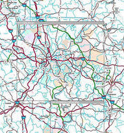
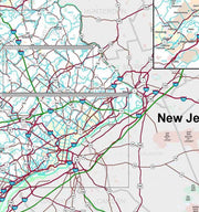
Rand McNally's regional wall map of Philadelphia is ideal for anyone needing a comprehensive representation of the area for planning, routing, or reference. It's a great choice for business and sales strategy, urban development, social work outreach, education, and marketing. Philly residents, businesses, and government offices are sure to find this wonderful reference tool irreplaceable.
The laminated wall map is printed with UV-resistant ink to help prevent color fading.
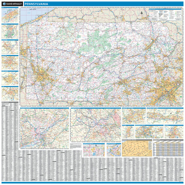
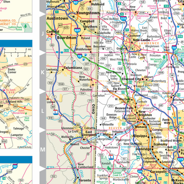
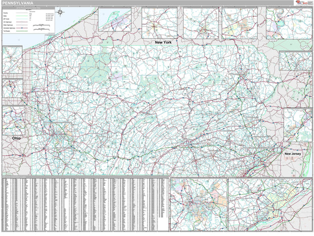
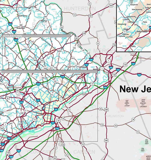
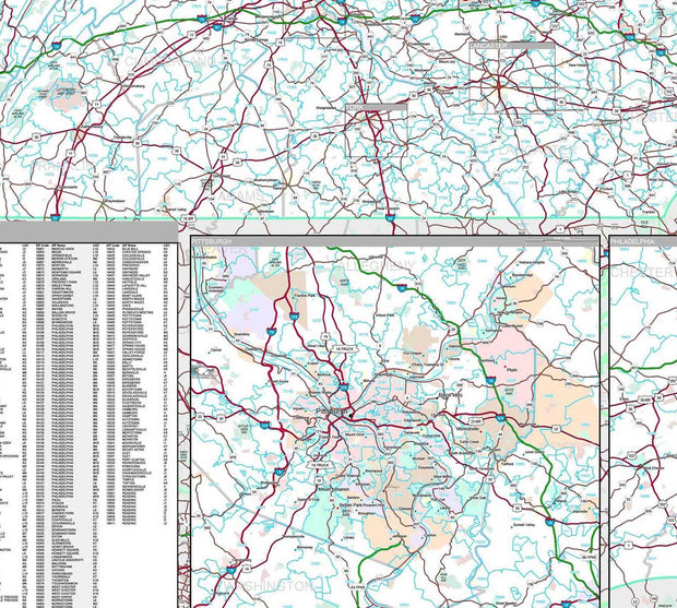
Map details include state highways, federal highways, county highways, county boundaries, city shading, cities and towns, major waterways, state/national parks, campsites, exit numbers, rest areas, military installations, airports, golf courses, universities, and much more.
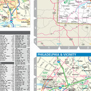
You'll also find a city/county index on the map and a driving times map between major cities in the region.
This truly complete wall map even includes a hanging kit with rails for easy mounting just about anywhere.
Coverage Area
Coverage area extends approximately 73 miles north-to-south and 72 miles east-to-west and is roughly bounded by New Ringgold, PA; east to Princeton, NJ; south to Chesilhurst, NJ; and west to Calvert, MD.
Premium Style Wall Map of Pennsylvania by Market Maps
PAWM006-1
Regular price
$118.75
Save money on our full line of wall maps from one of the industry leaders in wall maps. These always up to date, eye catching wall maps come in a variety of sizes and finishing options sure to meet your specific mapping needs.
Features include:
Interstate/Us/State Highways
5-Digit ZIP Codes
County Names and boundaries
Cities and Towns as applicable
All water
Institutions
Cemetery
Airports
Golf Courses
Parks
Populated Places Shaded
ZIP Code index with grid locator
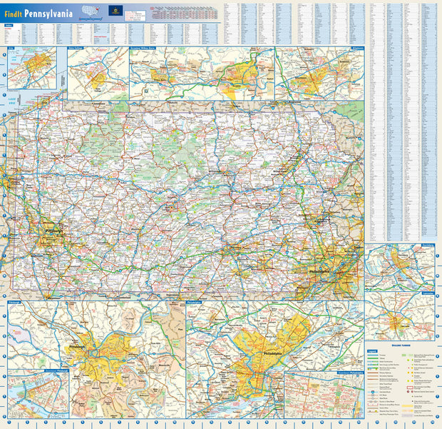
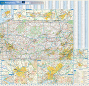
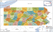
Pennsylvania Wall Map by Globe Turner
PAWM002-1
Regular price
$29.95
This colorful, easy-to-read state map of Pennsylvania identifies all major thoroughfares, secondary roads, freeway interchanges, rest areas, distance markers, landmarks, recreational areas, and more. Shaded relief on the state map provides a three-dimensional sense of Pennsylvania's topography. Detailed city inset maps of Allentown, Erie, Harrisburg, Lancaster, Philadelphia, Pittsburgh, Scranton/Wilkes-Barre, and State College are based on the latest street information from our cartographic experts. Up-to-date insets of center city Philadelphia and downtown Pitttsburgh provide must-see information on these tourist areas. County and city indices make it simple to locate even the smallest town.
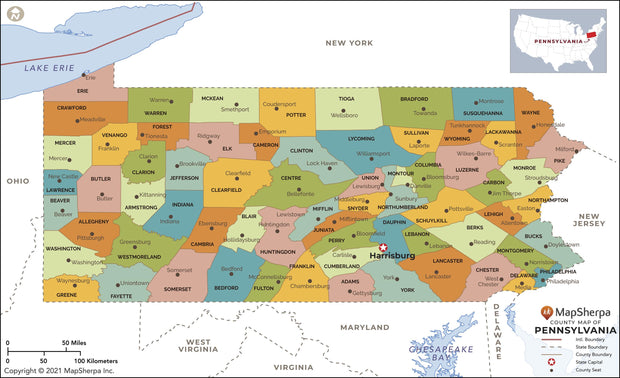
Pennsylvania County Map
PAWM004-1
Regular price
$39.95
This map has been created and designed for reference or business use. Clear and clean colors & fonts matched with cartographic research makes this map of Pennsylvania Counties Map easily readable and useful. The map shows the 67 counties of Pennsylvania and their borders across the Keystone State.
Pennsylvania Zip Code Map with Counties
PAWM005-1
Regular price
$39.95
This map has been created and designed for business or reference use. Clear and clean colors & fonts matched with cartographic research makes this Pennsylvania Zip Code Map with Counties easily readable and useful. The map shows the 67 counties of Pennsylvania and the borders of the over 1,700 zip codes across the Keystone State.