This beautiful reproduction is printed on heavy, acid-free stock and is excellent for framing.
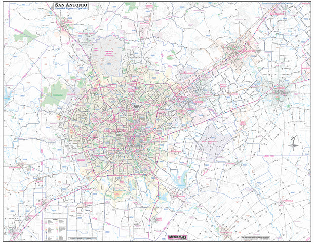
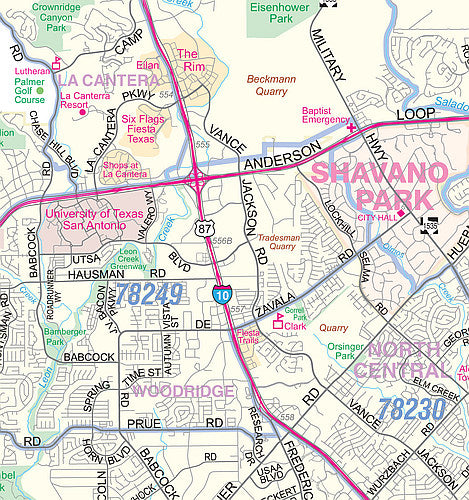
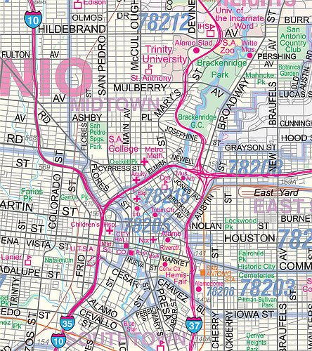
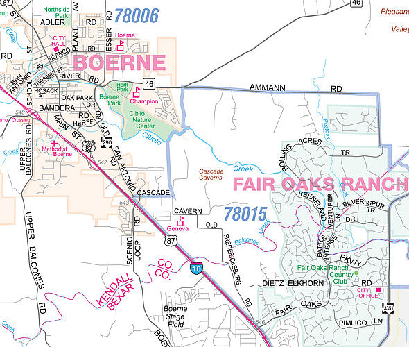
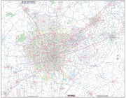
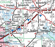
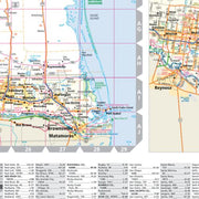
San Antonio Regional Area Major Arterial Wall Map
WALL046-1
Regular price
$59.95
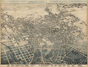
This up to date map of the San Antonio regional area features up-to-date major roads, cities, highways, zip code boundaries, lakes, hospitals, high schools and more. Area of coverage includes: West to Castroville, North to include Boerne and New Braunfels, East - to include Seguin South to include Floresville and Devine.
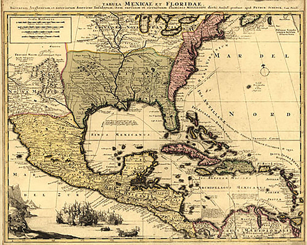
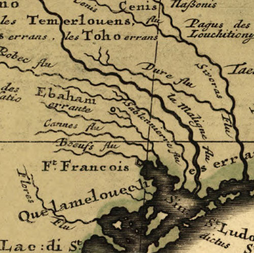
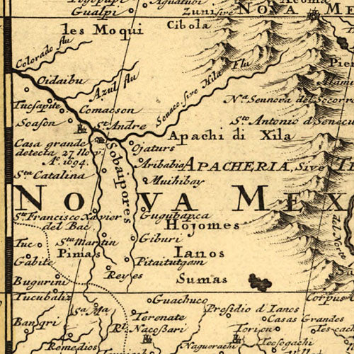
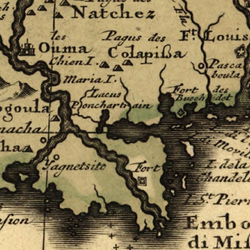
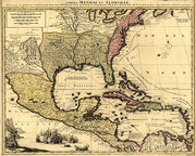
Tabula Mexicae et Floridae, 1710
TX00300
Regular price
$39.95
Tabula Mexicae et Floridae, 1710
This beautiful reproduction is printed on heavy, acid-free stock and is excellent for framing.
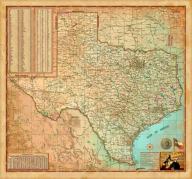
Texas "Antiqued" Wall Map
TXWM017A-1
Regular price
$39.95
This decorative map of Texas is colorful and easy-to-read featuring topography in shaded relief. Beautiful as well as functional, this map will brighten any office or study.
Features include:
Index of counties & larger towns and cities
Simple distance chart
population data
Antique Finish
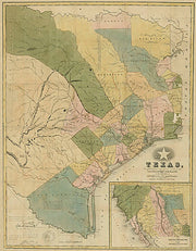
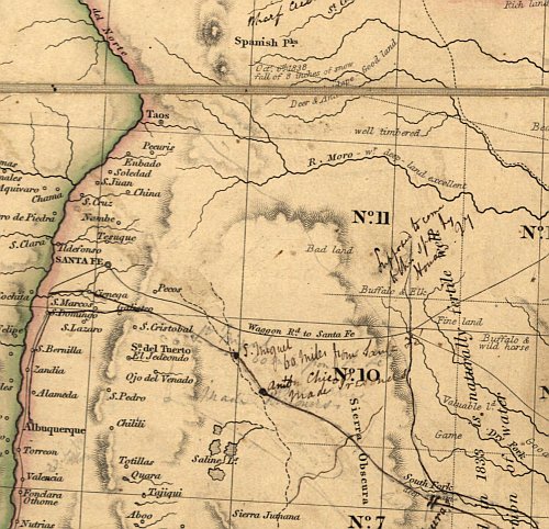
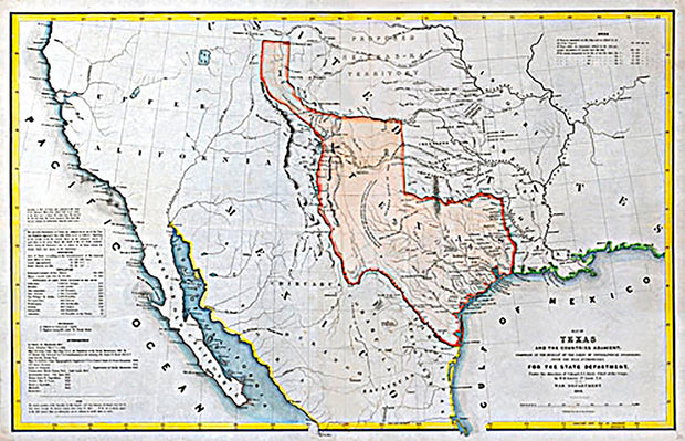
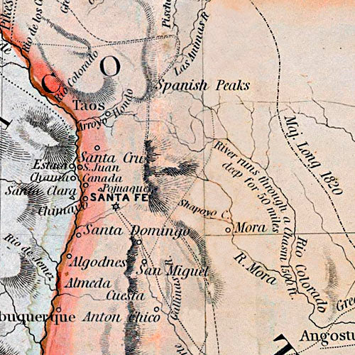
Texas 1835 by J. H. Young
TX0790
Regular price
$39.95
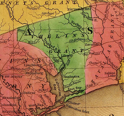
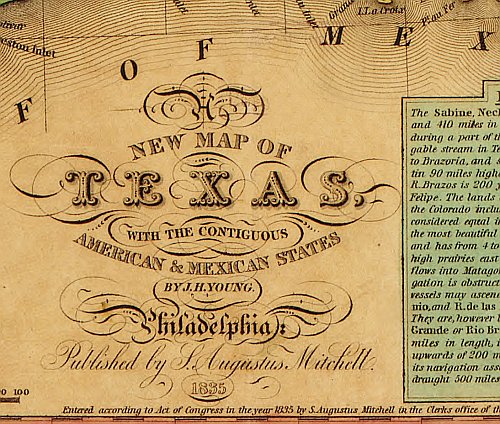
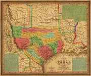
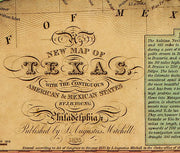
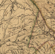
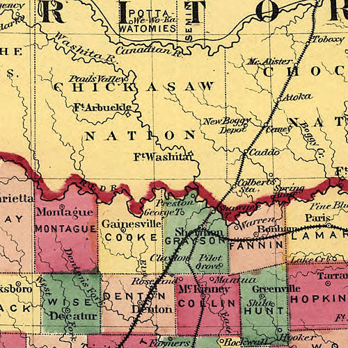
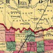
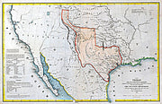
This striking map produced just before Texas declared it's independence from Mexico shows colonies and land grants, the Neuces River as the border between Texas and Mexican states, Indian Territory attached to Arkansas, Santa Fe area, towns, rivers, and roads. The three text boxes discuss at some length the land grant system (Land Grants), the physical nature, political environment and emigrant status (Remarks on Texas), and the nature and navigability of Texas rivers (Texas Rivers).
This striking map produced just before Texas declared it's independence from Mexico shows colonies and land grants, the Neuces River as the border between Texas and Mexican states, Indian Territory attached to Arkansas, Santa Fe area, towns, rivers, and roads. The three text boxes discuss at some length the land grant system (Land Grants), the physical nature, political environment and emigrant status (Remarks on Texas), and the nature and navigability of Texas rivers (Texas Rivers). This beautiful reproduction is printed on heavy, acid-free stock and is excellent for framing.
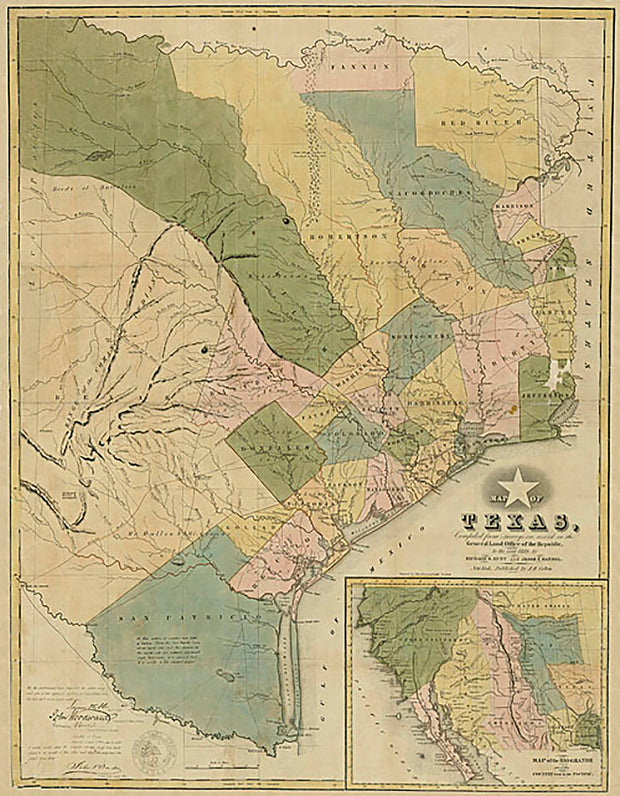
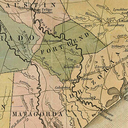
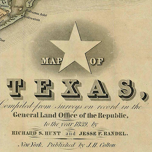
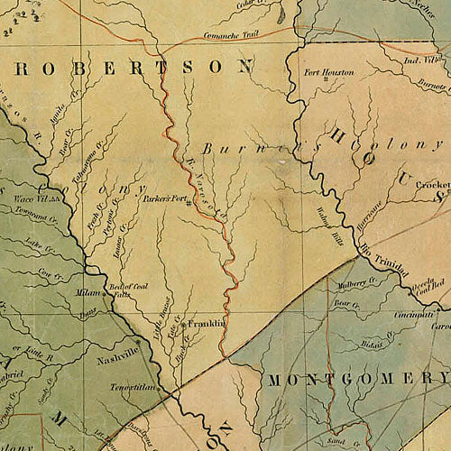
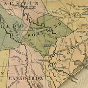
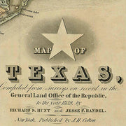
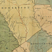
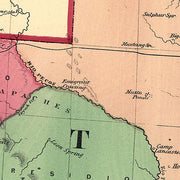
Texas 1839, General Land Office of the Republic
TX00310
Regular price
$39.95
Texas 1839, General Land Office of the Republic
This beautiful reproduction is printed on heavy, acid-free stock and is excellent for framing.
23" x 31"
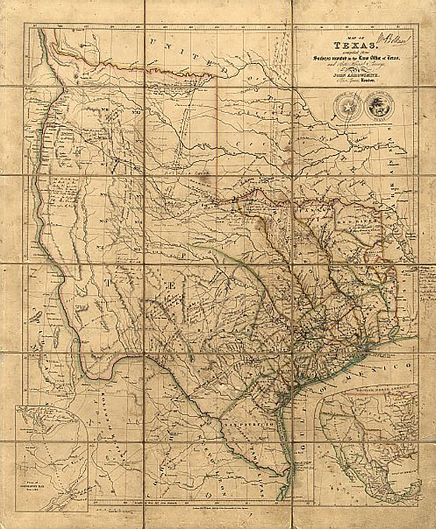
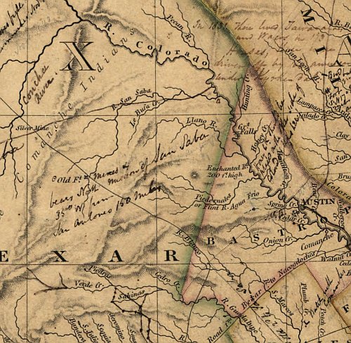
Texas 1841 by John Arrowsmith
TX0780
Regular price
$42.95
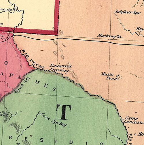
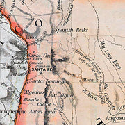
This fascinating map published during the period of The Republic by the London firm of John Arrowsmith is quite literaly covered with hand written notes (see detail link below) by an Englishman named Wm. Bollaert who had come to Texas at the behest of his friend William Kennedy who was subsequently appointed British consul at Galveston. Mr. Bollaert was commissioned to write a report for the British Admiralty and hoped to someday write a commercial book (he never did) about his travels in Texas. You can learn more about Mr. Bollaert at the Handbook of Texas Online. This beautiful reproduction is printed on heavy, acid-free stock and is excellent for framing.
This fascinating map published during the period of The Republic by the London firm of John Arrowsmith is quite literaly covered with hand written notes (see detail link below) by an Englishman named Wm. Bollaert who had come to Texas at the behest of his friend William Kennedy who was subsequently appointed British consul at Galveston. Mr. Bollaert was commissioned to write a report for the British Admiralty and hoped to someday write a commercial book (he never did) about his travels in Texas. You can learn more about Mr. Bollaert at the Handbook of Texas Online. This beautiful reproduction is printed on heavy, acid-free stock and is excellent for framing.
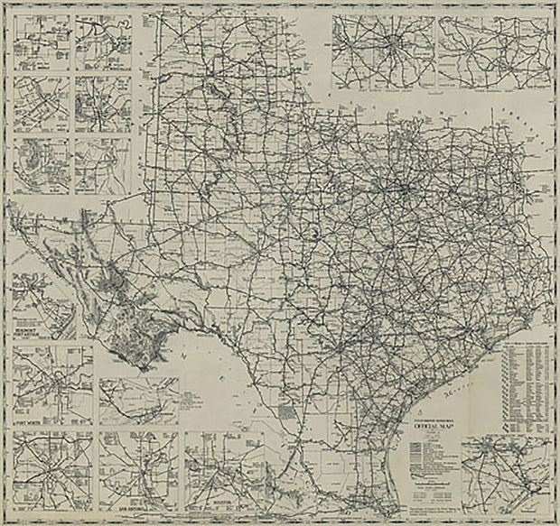
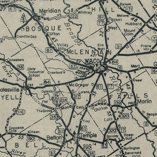
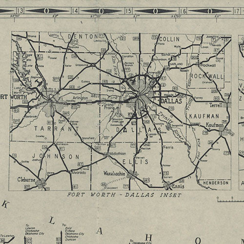
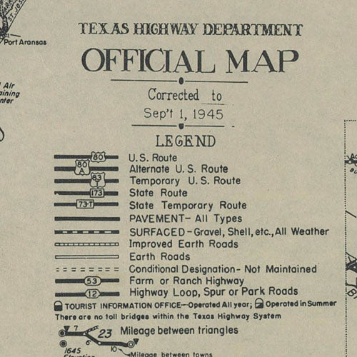
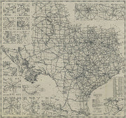
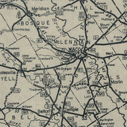
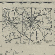
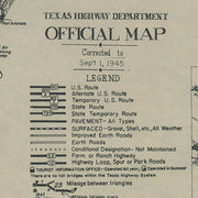
Texas 1945, Texas Highway Department
TX00330
Regular price
$39.95
Texas 1945, Texas Highway Department
This beautiful reproduction is printed on heavy, acid-free stock and is excellent for framing.
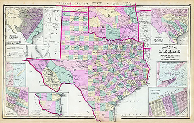
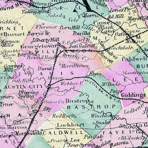
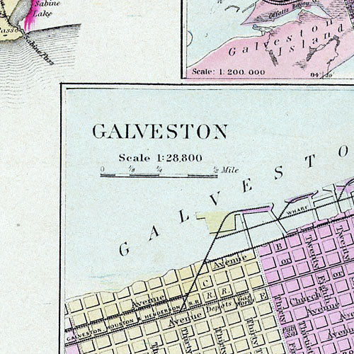
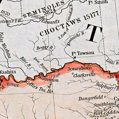
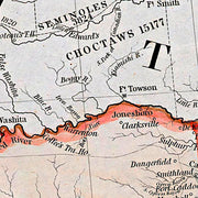
Texas and Indian Territory 1876
TX0420
Regular price
$39.95
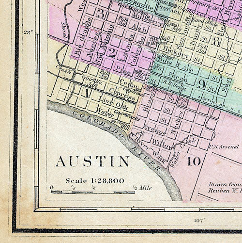
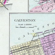
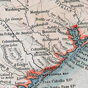
What sets this map by Frank Gray apart from the others of this period are the seven inset maps that show: the rivers of Texas and their tributaries, a “Hypsometric Sketch of Texas” that depicts the topography, Galveston, Galveston Bay, Matagorda Bay, Austin, and the southern tip of Texas. This beautiful reproduction is printed on heavy, acid-free stock and is excellent for framing.
Texas and Indian Territory, 1875
TX00170
Regular price
$39.95
Texas and Indian Territory, 1875
This beautiful reproduction is printed on heavy, acid-free stock and is excellent for framing.
Texas Decorative Wall Map
TXWM017-1
Regular price
$39.95
This is a colorful and easy-to-read map featuring topography in shaded relief. Beautiful as well as functional, this map will brighten any office or study.
Features include:
Index of counties & larger towns and cities
Simple distance chart
population data
Vibrant colors
Texas Executive Wall Map
TXWM018-1
Regular price
$39.95
This extremely popular map includes all state, US and Interstate highways, cities & towns, airports, elevations, rivers, lakes, parks and county names and boundaries. Also included are inset maps of telephone area codes, statewide elevation contours and a mileage chart.
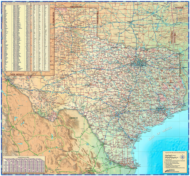
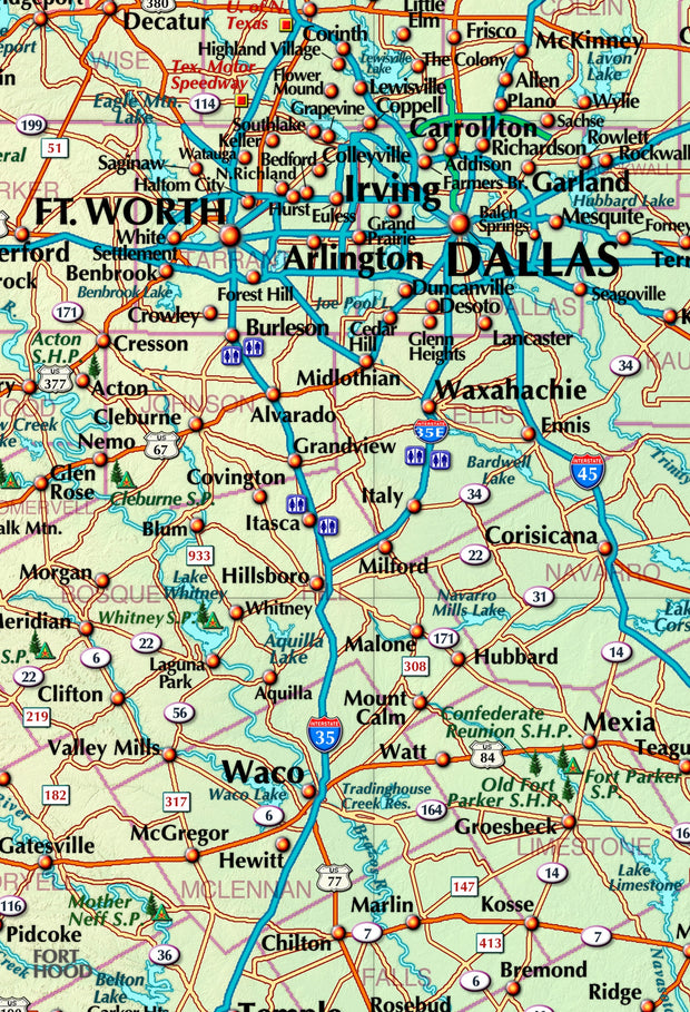
Texas Executive Wall Map by Topographics
TXWM104-1
Regular price
$99.95
This wall map of Texas, shows counties, towns, cities, villages, major roads and highways. Includes community index and inset maps of Houston, DFW and the Austin/San Antonio metro area.
47"W x 42"H
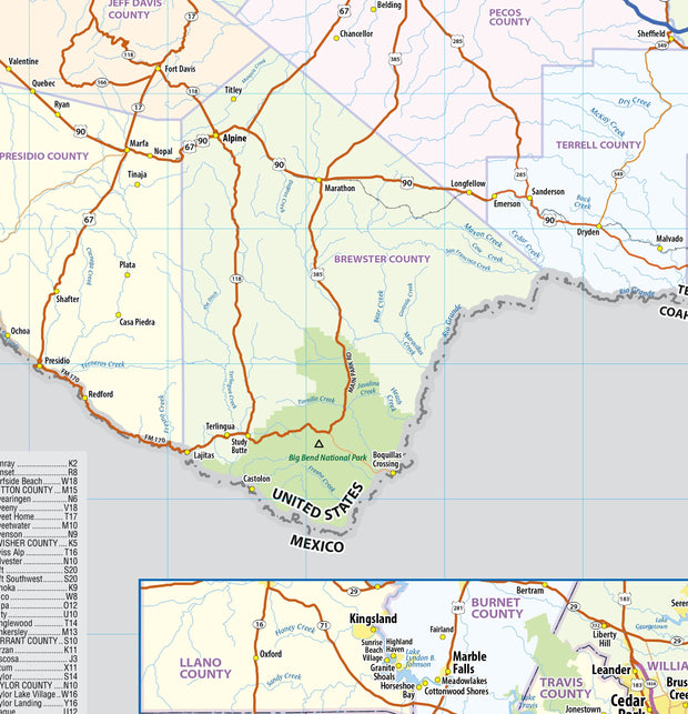
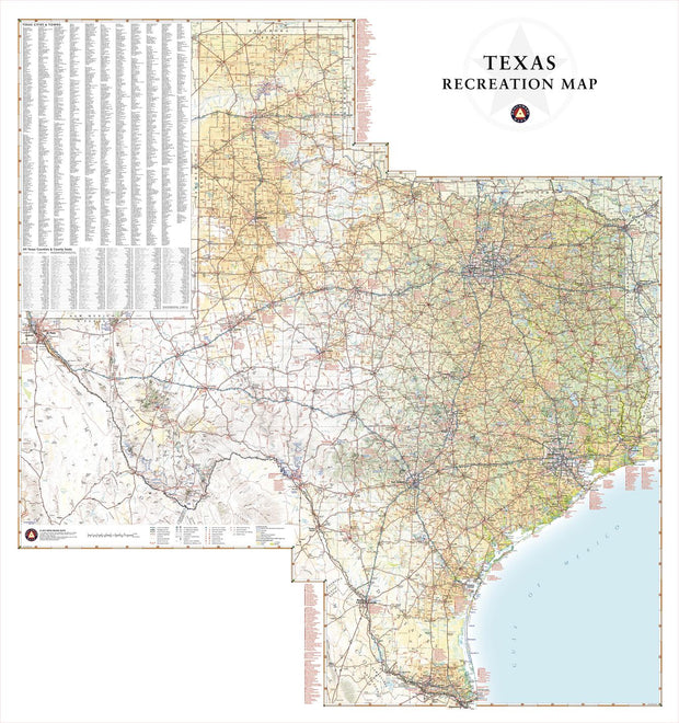
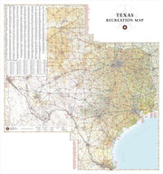
Texas Recreation Map by Benchmark Maps
TXWM032-1
Regular price
$44.95
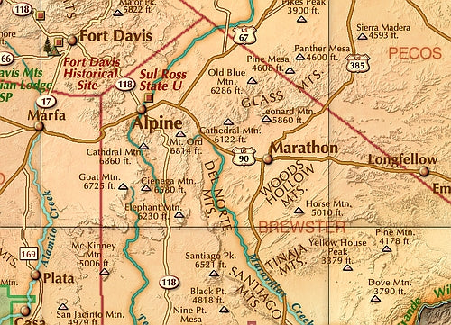
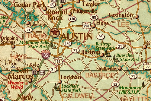
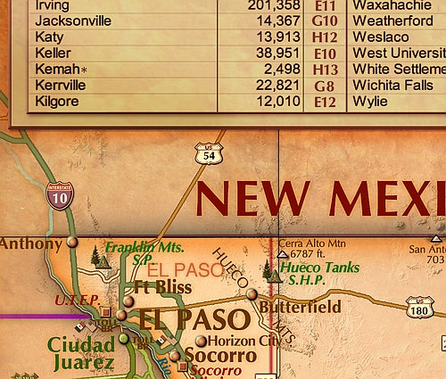
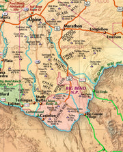
Texas has a reputation for big country, big cities, and Big Bend National Park. This wall map illustrates the vast countryside and recreation attractions throughout The Lone Star State, from Gulf Coast and fields of Blue Bonnets in the east to the panhandle’s Palo Duro Canyon and the Guadalupe Mountains in the west.
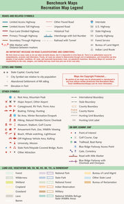
If outdoor adventure and recreation is your thing, this is the map for you. This map is loaded with points of interest from camping sites, hiking trails, fishing spots, and bird watching locations ( see legend shown on 2nd picture) this map depicts all the best recreation locations. Not only functional this exquisite map uses shaded relief to portray the land a technique which combines shading with elevation tints that portray landforms much more clearly than contour lines. These techniques and elevation colors make mountains, highlands and valleys immediately obvious.
Beautiful as well as functional this map will look great in a home, office, cabin, RV or wherever you choose to hang it
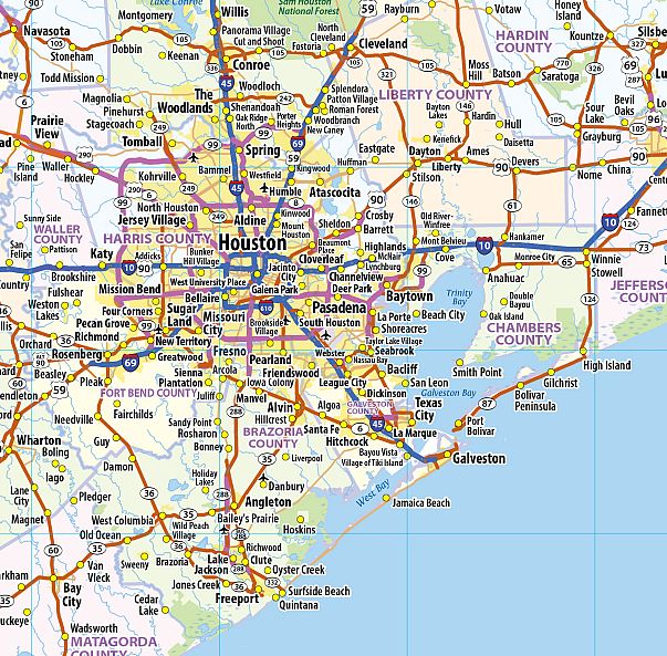
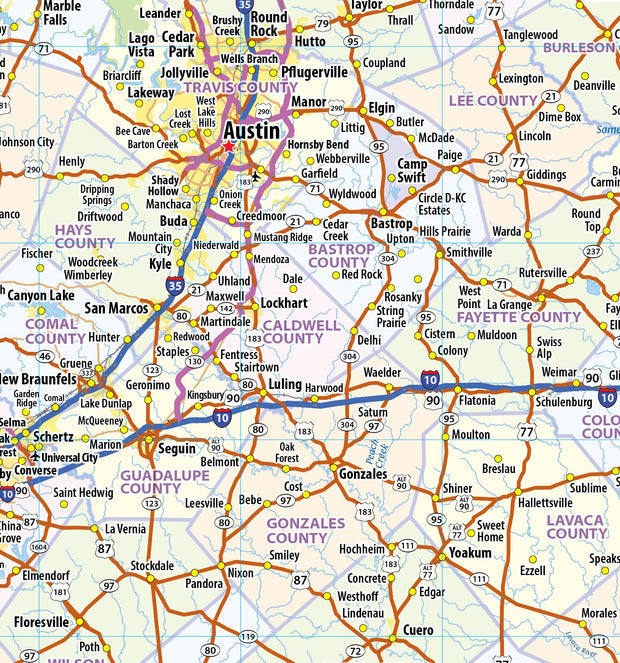
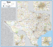
Texas Wall Map by Globe Turner
TXWM002-1
Regular price
$29.95
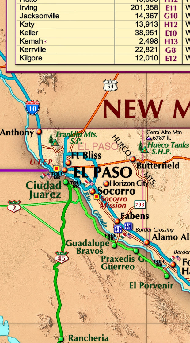
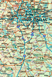
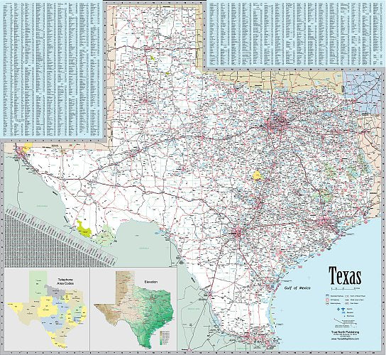
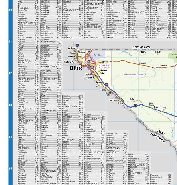
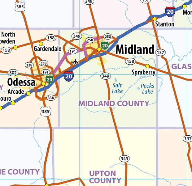
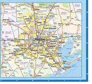
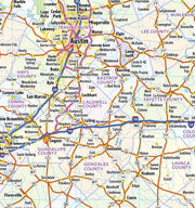
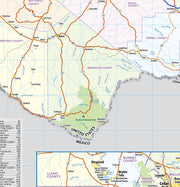
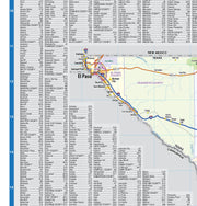
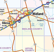
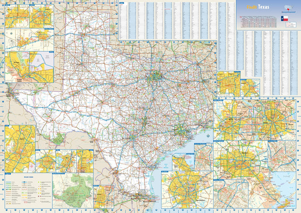
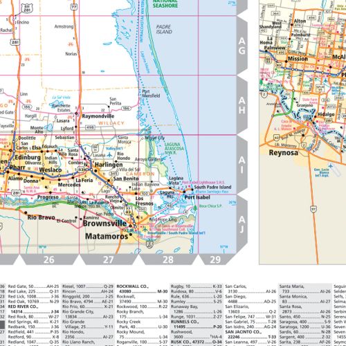
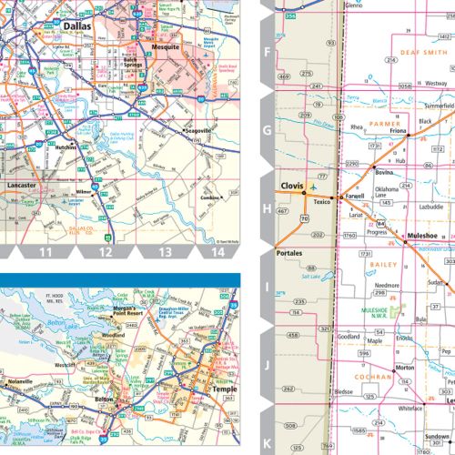
This colorful, easy-to-read state map of Texas identifies all major thoroughfares, secondary roads, freeway interchanges, rest areas, distance markers, landmarks, recreational areas, and more. Shaded relief on the state map provides a three-dimensional sense of Texas' topography. Detailed city inset maps of Abilene, Amarillo, Austin, Beaumont, Corpus Christi, Dallas / Fort Worth, El Paso, Houston / Galveston, Laredo, Lubbock, McAllen, Odessa / Midland, San Antonio, Texarkana, and Waco are based on the latest street information from our cartographic experts. The map also includes up-to-date insets of downtown Dallas, downtown Houston, downtown San Antonio, and Big Bend National Park. County and city indices make it simple to locate even the smallest town.
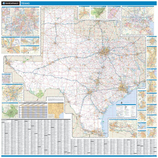
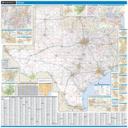
Texas Wall Map by Rand McNally
TXWM025
Regular price
$229.00
Laminated with Hanging Rails
60" W x 60" H
Index of Counties and Cities
Fully Indexed Counties, Cities, Mileage Chart
Inset Maps of All Major Cities
Free Shipping!
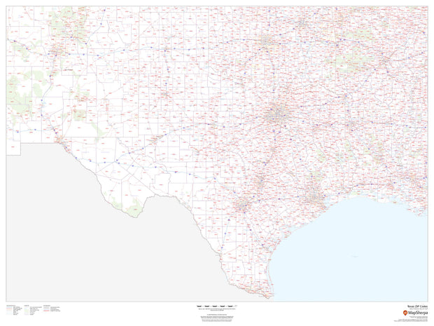
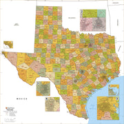
Texas Zip Code Map
TXWM003-1
Regular price
$59.95
This map of Texas shows ZIP codes overlaid on a road map. Base map features include county boundaries, major road network features, and state and national parks and conservation areas.
48"W x 36"H
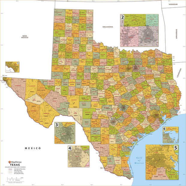
Texas Zip Code Map with Counties
TXWM005-1
Regular price
$39.95
This map has been created and designed for business or reference use. Clear and clean colors & fonts matched with cartographic research makes this Texas Zip Code Map with Counties easily readable and useful. The map shows the 254 counties of Texas and the borders of the over 1,900 zip codes across the Lone Star State.
The Republic of Texas, 1844
TX00110
Regular price
$39.95
The Republic of Texas, 1844
This beautiful reproduction is printed on heavy, acid-free stock and is excellent for framing.